
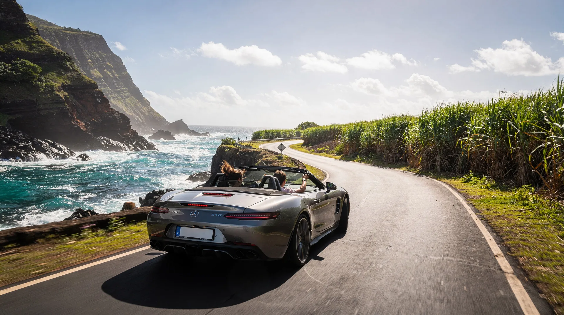
Road trip in Mauritius: 7-10 day island tour by car
Updated: August 2026
Road trip in Mauritius: touring the island in total freedom
Mauritius is perfectly sized for a road trip. 65 km from north to south, 48 km from east to west — big enough for every region to have its own identity, small enough to go from a west coast beach to an east coast cove in under 2 hours. With a rental car, you get access to places organized tours never visit.
This road trip traces a full loop around the island, hugging the coast and regularly cutting inland to explore the mountainous interior. Mauritius’s coastal road is one of the most varied in the Indian Ocean: at times lively and resort-lined in the north, at times wild and desolate in the south, always spectacular. To complement this guide, read our story of a road trip through the wild south, which covers one of the itinerary’s most dramatic stretches in detail.
Driving in Mauritius means driving on the left (as in the UK) — a quick adjustment for most French travelers. The rules of the road are similar, signage is in English and French, and roads are generally in good condition on the main routes.
At a glance
| Where | Full island tour: north, east, south, southwest, west, Port-Louis and the center |
| Total distance | Roughly 370-450 km over 7 days (600-800 km with the 10-day option) |
| Estimated budget | Roughly €1,335 to €2,250 for two, excluding flights (see detailed budget) |
| Getting there | Rental car required, picked up at the airport |
| Best time to go | May to December for dry roads, avoiding January-February — see our guide to the best time to visit |
Getting ready for the road trip
Renting the right car
For a week-long road trip or longer, our guide to renting a car in Mauritius covers all the practical advice. In short:
Small city car (Suzuki Alto, Toyota Vitz): Economical to run and easy to park. Fine if you stick to the main roads. Limitation: not very comfortable on southern tracks or for families with lots of luggage.
Compact sedan (Toyota Yaris, Suzuki Swift): The best compromise. Decent comfort, reasonable fuel consumption, handles most secondary roads. Our recommendation for most travelers.
SUV or 4x4: Essential if you want to explore the national park’s forest tracks or the south’s dirt roads. More expensive (€50-80/day) but opens up access to otherwise unreachable areas.
Average rate: €30-50/day for a city car, €50-80 for an SUV. Book ahead (especially in high season) and compare local agencies with the big international chains — often cheaper for equivalent service.
Navigation and maps
Google Maps works very well in Mauritius with mobile data (a local prepaid SIM costs under €15 for 10 GB, available at the airport). Download offline maps before you leave, just in case.
Important: GPS and Google Maps don’t always know the small coastal roads or local shortcuts. Always ask your host or a local for alternative routes — often more scenic than the main road.
Fuel and gas stations
Gas stations (ENGEN, Total, BP) are common on all main routes. Fuel is cheaper than in France. Fill up regularly — some coastal roads in the south go 30-40 km without a station.
Accommodation logistics
For a road trip, you’ll change accommodation several times. Our guide where to stay in Mauritius helps you identify the best areas for each stop. Book at least the first and last nights ahead of time; for the nights in between, a booking 24-48 hours out is usually enough outside high season.
The itinerary at a glance
| Day | Leg | Approx. distance | Overnight |
|---|---|---|---|
| 1 | Airport — Grand Baie | 45-60 min | Grand Baie |
| 2 | Grand Baie — Cap Malheureux — Poste de Flacq | ~60 km | Grand Baie or Flacq |
| 3 | Flacq — Trou d’Eau Douce — Belle Mare — Mahebourg | ~55 km | Mahebourg |
| 4 | Mahebourg — Blue Bay — Souillac — Bel Ombre | ~70 km | Bel Ombre |
| 5 | Bel Ombre — Le Morne — Chamarel | ~40 km | Chamarel or Le Morne |
| 6 | Chamarel — Tamarin — Flic en Flac — Port-Louis | ~65 km | Flic en Flac |
| 7 | Flic en Flac — Port-Louis — center — return north | ~80 km | Grand Baie |
| 8-10 | Free days based on your interests (see options below) | Variable | Variable |
Should you rent a GPS or an eSIM for this road trip?
To find your way without relying on hotel wifi, an eSIM or local SIM card with data is practically essential for a road trip — Google Maps works well but uses data continuously over 7 to 10 days of driving. Budget around fifteen euros for a comfortable data plan, activated as soon as you arrive at the airport or before departure for an eSIM. Always keep a paper map or an offline screenshot of the main stages handy in case of no signal, especially in the wild south and the inland roads.
Day 1: arrival and first leg — northwest
Picking up the vehicle
If you arrive in the morning or early afternoon, pick up your car at the airport. Rental agencies are in the arrivals hall. Check the vehicle’s condition carefully before signing — photograph every existing scratch. Make sure you have the rental documents, the insurance, and the agency’s emergency contact.
The drive from the airport toward the north (M2 motorway) takes 45-60 minutes and gives you a first glimpse of the Mauritian landscape: farmland with the central mountain range in the background.
First night — Grand Baie
Settle in at Grand Baie or Trou aux Biches for this first night. Grand Baie is the ideal base to kick off a road trip: easy car rental, lively restaurants, well-stocked supermarkets for water and snacks. Take a drive around town in the evening to get your bearings and spot landmarks.
Day 2: the north and northeast coast
Leg: Grand Baie — Cap Malheureux — Grand Gaube — Poste de Flacq
Total distance: around 60 km, 2-3 hours with stops.
Leave Grand Baie early in the morning heading toward Cap Malheureux (15 km north). The red church and the view over the northern islands are the must-stop photo spot — morning light is ideal for photography. Coin de Mire, Flat Island and Gabriel Island stand out on the horizon.
Continuing east, the road follows the coast through increasingly authentic fishing villages. Grand Gaube is a well-preserved fishing village, with colorful boats and nets drying on the beach. Roches Noires, further east, is a lesser-known beach with sometimes choppy but beautiful waters.
The road continues to Poste de Flacq and Centre de Flacq. Sugarcane fields stretch as far as the eye can see inland, with the central mountains rising in the distance. It’s the most typical image of the Mauritian countryside. Our guide to markets and culture points out the markets not to miss along this stretch.
Recommended stops: Flacq market (Wednesday and Sunday), Roches Noires beach, Grand Gaube village.
If you’d like to enjoy the calm waters of the northern lagoon before hitting the road, a morning jet-ski trip or water activity from Grand Baie is possible: see water activities from Grand Baie.
Lunch: The small Mauritian snack stalls in Flacq or Poste de Flacq serve fried noodles, dholl puri and homemade biryani at bargain prices.
Day 3: the east coast — beaches and villages
Leg: Flacq — Trou d’Eau Douce — Belle Mare — Mahebourg
Total distance: around 55 km, 2-3 hours.
The east coast is the island’s least developed. Its white-sand beaches are often nearly empty outside the big hotels. Belle Mare and Palmar are this coast’s finest beaches — wide, white and lined by a deep blue sea. Our guide to Mauritius’s best beaches ranks Belle Mare in the island’s top 5.
Trou d’Eau Douce is the departure point for boats to Ile aux Cerfs. If you haven’t visited the island yet, take a half-day trip from here — it’s worth the detour. Otherwise, continue south.
The road follows the coast down to Mahebourg, passing fishing villages where traditional colorful pirogues sit beached on the sand. Pointe d’Esny, just before Mahebourg, is a quiet haven with an unspoiled beach facing Ile aux Aigrettes.
Night in Mahebourg: This port town deserves a night. Its waterfront, historical museum and fish restaurants make it an authentic stop far from the tourist zones. If it’s a Monday, Mahebourg’s weekly market is not to be missed.
Day 4: the south — Blue Bay and the wild coast
Leg: Mahebourg — Blue Bay — Souillac — Bel Ombre
Total distance: around 70 km, 3-4 hours with stops.
Blue Bay in the morning (arrive before 9am for the best snorkeling). The Blue Bay marine park is one of the finest snorkeling spots in the whole region. You can book a snorkeling trip at Blue Bay with gear provided to explore the coral reef in the best conditions. Continue southeast onto increasingly quiet roads.
The south coast between Rivière des Anguilles and Souillac is the island’s wildest. Black lava cliffs drop straight into the sea with no beach in sight. Indian Ocean waves, unchecked by any reef, break with spectacular force. This is a side of Mauritius many tourists never see.
Gris-Gris in Souillac is the island’s most striking cliff site — not for swimming (it’s dangerous), but for watching the raging ocean from the black rocks. To explore the south coast on foot with a local guide who knows every corner, the walking tour of southern Mauritius from Souillac is an original, immersive option. Trou du Souffleur in La Gaulette (a bit further west) is a natural blowhole triggered by the waves — spectacular in rough seas.
Night in Bel Ombre: The Bel Ombre region, on the southwest coast, is one of the least commercially developed yet most beautiful. A few lodges and guesthouses offer simple accommodation in a stunning setting, surrounded by colonial estates and forests.
Day 5: the southwest — Le Morne and Chamarel
Leg: Bel Ombre — Le Morne — Chamarel
Total distance: around 40 km, with numerous stops.
This leg is one of the road trip’s most spectacular. The Le Morne Brabant peninsula appears around a bend — a tabletop mountain rising out of the sea, ringed by a lagoon of unreal blue. This UNESCO-listed site is one of the most photographed in Mauritius. Take time to stop in the cove and walk along the beach. If you’re into watersports, kitesurfing lessons run right on the beach.
The road between Le Morne and Chamarel winds up into the mountains. Chamarel packs several wonders into just a few kilometers: the Seven Coloured Earths, a 100-metre waterfall, the coffee plantation, the artisanal rum distillery.
For those who’d like a guided visit, you can book a Chamarel excursion with the waterfall and colored earths directly online. Our guide to Chamarel covers all the site’s attractions in detail. Allow half a day.
Lunch in Chamarel: The Rhumerie de Chamarel is a must for its panoramic view over the coast. The food (Creole dishes, cod fritters, fish curry) matches the setting — a memorable meal with a view over the ocean and hills.
Day 6: the west coast — Flic en Flac and Tamarin
Leg: Chamarel — Tamarin — Flic en Flac — Port-Louis
Total distance: around 65 km.
The descent from Chamarel to the west coast is striking: the road winds down the mountain with a view over the turquoise lagoon in the distance. Tamarin, a surf and fishing village at the foot of the cliffs, is worth a lunch stop by the water.
Tamarin’s bay is known for its dolphins. Early in the morning (before 8am), groups of spinner dolphins (Stenella longirostris) regularly enter the bay to swim and play. Many agencies offer boat trips to swim with dolphins — an out-of-the-ordinary experience.
You can book your dolphin swim in Tamarin ahead of time to secure your spot. If this experience interests you, plan for it the next morning.
Flic en Flac is the west’s long straight beach, with its terrace restaurants and legendary sunsets. The northern road from Flic en Flac hugs the coast toward Port-Louis, passing Albion (lighthouse and cliffs) and Pointe aux Sables.
Night in Flic en Flac: The west coast is ideal for a night, especially for the sunset over the sea from the beach or a restaurant terrace. Flic en Flac’s dive clubs run excellent trips the next morning if diving interests you.
Day 7: Port-Louis and the island’s center
Leg: Flic en Flac — Port-Louis — island center — return north
Total distance: around 80 km round trip.
Port-Louis deserves a half-day on foot. Park at the Caudan Waterfront car park (paid but secure) and explore the capital on foot: the central market, Chinatown, Place d’Armes, Fort Adelaide. The central market in the morning is one of the island’s liveliest sights — spices, fresh fish, tropical fruit, every facet of Mauritian cuisine in a single place.
After Port-Louis, the road north can go through the island’s center rather than along the coast. This inland route crosses completely different landscapes: the Moka heights with their colonial houses, the Curepipe tea estates, the Jardin de la Compagnie in Curepipe (a highland town at 550 metres elevation).
The town of Curepipe has a different micro-climate from the rest of the island — a few degrees cooler with more frequent rain. Its carpet market and craft market are worth a quick stop.
Return north: Head back down to Grand Baie via the highland road for one last panoramic view over the north coast and the islands.
Days 8-10 (10-day option): going deeper
If you’ve planned 10 days for this road trip, the 3 extra days let you either return to favorite spots or explore two areas the main itinerary doesn’t fully cover.
National Park option: A day’s hike in the Black River Gorges. Several trails from 2 to 6 hours let you explore the primary forest and spot Mauritius’s rarest endemic species. The Discovery Centre at the park entrance provides maps and wildlife information.
Ile aux Cerfs and East Coast option: Return to the east coast for a full day on Ile aux Cerfs, with an organized dive and a grilled-fish lunch. If you haven’t yet swum in the island’s turquoise lagoon, this is a priority.
Swimming with dolphins option: A morning in Tamarin for a boat outing with the spinner dolphins. Set off before sunrise to maximize your chances of an encounter.
Relaxation option: Two days of pure beach time, with no plans, to recover from the road trip’s demanding pace. The beach at Trou aux Biches or Belle Mare are perfect for this well-earned break.
Spa option: After several days on the road, a couple’s treatment at a big hotel spa is a welcome recovery. Treatments with local essential oils (ylang-ylang, vetiver) are a Mauritian specialty worth trying at least once.
Insurance and documents to check before hitting the road
Before signing the rental contract, check exactly what the included insurance covers: the excess in case of an accident (often high, €500-1,000, reducible by paying a daily supplement), tire and windshield coverage (frequently excluded), and roadside assistance in case of a breakdown on an isolated road in the south.
A French driving licence is enough for short stays, but bring an ID as well and keep a photo of the rental contract on your phone. Also consider travel insurance that covers medical costs, useful in case of a minor road accident — minor collisions with two-wheelers or animals aren’t uncommon on secondary roads.
Practical tips for driving in Mauritius
Driving on the left: Adjusting usually takes less than an hour. The main danger for French drivers is ending up on the left side of the road after a stop or roundabout. Stay especially focused in those moments. Sticking a small “LEFT” reminder on the dashboard can help for the first few hours.
Roundabouts: Mauritius is covered in them. Priority goes to the left (i.e., to those already in the roundabout), unlike the habits some French drivers may have from certain older roundabouts.
Honking: Mauritians honk a lot — it’s cultural, not aggressive. A honk can mean “I’m here,” “I’m passing you” or “thank you.” Don’t take it personally.
Pedestrians and animals: Stay alert in villages. Children, dogs and goats can cross without warning. Always slow down when approaching built-up areas.
Parking: Generally easy outside town centers and Port-Louis. In Port-Louis, use the official paid car parks at Caudan Waterfront.
Rush hour: 7-9am and 4-6pm around Port-Louis and major urban centers. Avoid these windows if possible — traffic jams can triple travel times. Plan your passes through the capital outside these hours.
Estimated road trip budget
For two people, 7 days, moving on each evening:
- Varied accommodation (guesthouses + one hotel night): €60-100/night, or €420-700
- Car rental: €35-50/day, or €245-350
- Fuel: €70-100 (around 600-800 km driven)
- Meals (local restaurants and a few fine dining ones): €400-700
- Activities (islands, snorkeling, site entries): €200-400
- Estimated total: €1,335 to €2,250 for two, excluding flights
Our complete Mauritius budget guide breaks down every expense to plan for, item by item.
Mauritius road trip playlist
You can’t do a road trip in Mauritius without the right soundtrack. A few Mauritian artists for the mood: Cassiya (classic sega), Ram Joganah (sega coné), Menwar (protest sega), and for gentler moments, songs by Ti-Paris or Claudette and Ti-Frère. Sega is the traditional music of Mauritius — upbeat, joyful, born from the suffering of slavery transformed into a celebration of life.
If this road trip has made you want an even more adventurous itinerary, our 14-day itinerary offers an in-depth exploration including Rodrigues.