
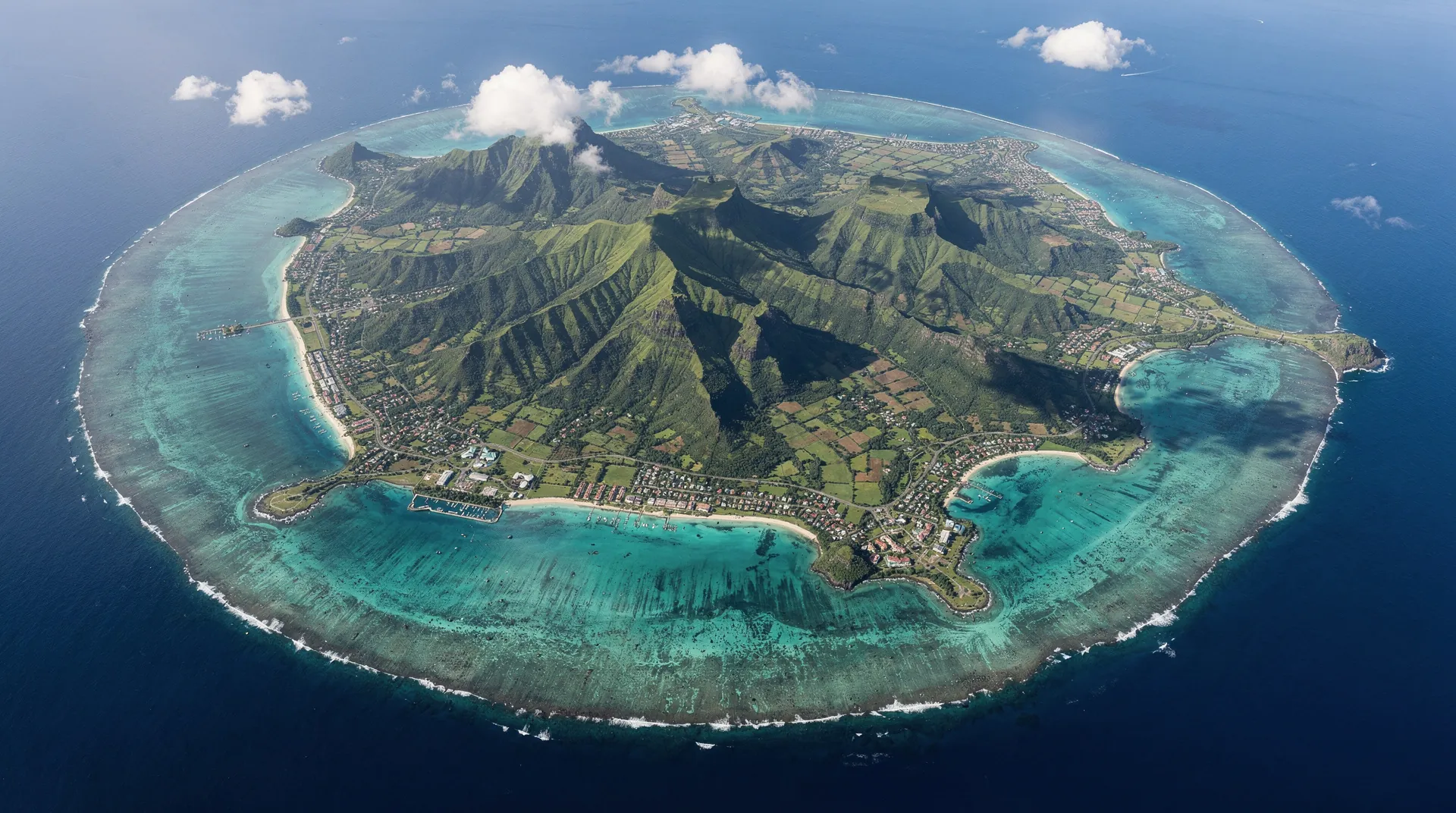
Map of Mauritius: geography, regions and distances
Updated: August 2026
At a glance
| Area | 1,865 km², 65 km north to south, 48 km east to west |
| 4 coasts | north (lively), east (wild and windy), west (sunset views), south (the wildest) |
| Maximum distance between two points | generally under 2 hours by road |
| Best time to explore the island | May to December, outside the January-February lull |
| How to get around | rental car recommended for a proper tour of the island |
Understanding the geography of Mauritius
Mauritius is a small gem of 1,865 km², set in the Indian Ocean about 200 km east of Reunion Island and 900 km east of Madagascar. Its shape is roughly oval, slightly elongated from north to south (65 km north to south, 48 km east to west). For travelers used to the size of European countries, it’s surprisingly small — and yet Mauritius manages to pack in a diversity of landscapes, microclimates, and cultures that feel far larger than the map suggests.
Understanding the geography of Mauritius before you arrive saves time and helps you make better choices: where to stay, how to plan your days, which direction to head each morning. This knowledge is especially valuable if you’re planning a road trip in Mauritius or torn between the different coasts for your main base.
The island’s shape and geographic features
Volcanic origin
Mauritius is a volcanic island of oceanic origin, born from the depths of the Indian Ocean about 8 million years ago. The original volcano went extinct long ago — there’s no volcanic activity in Mauritius today. This volcanic past explains the richness of the soil (very fertile for sugarcane and tea), the distinctive shapes of the terrain, and the seven-colored volcanic earth at Chamarel.
The central highlands
The center of the island sits on a plateau at roughly 400 to 600 meters of elevation. This is where the main inland towns are found: Curepipe (550 m), Vacoas-Phoenix, Quatre Bornes, Rose Hill. Temperatures here run 3 to 5°C cooler than on the coast — welcome during the tropical summer, but capable of catching out travelers who packed only light clothing.
These highlands get more rainfall than the coasts and are therefore greener, cooler, and often cloud-covered. Sugarcane and tea farming dominate here.
The mountain ranges
Several mountain ranges rise above the plateau and form the island’s major visual landmarks:
The Moka Range north of the highlands, visible from Port Louis. Le Pouce (812 m) and Pieter Both (823 m, the island’s highest peak) dominate the landscape. These mountains are accessible for hiking from Moka — see our guide to hiking in Mauritius.
The southwest peaks, including Le Morne Brabant (556 m), standing alone on its peninsula and monumentally photogenic. This UNESCO World Heritage volcanic outcrop is visible from dozens of kilometers away. To stay nearby, check our guide to Le Morne.
Montagne du Lion in the southeast, whose profile does indeed resemble a lion lying down when seen from the sea — a major landmark along the Mahebourg coast.
The coral reef
Mauritius is ringed on three-quarters of its perimeter by a fringing coral reef. This reef creates coastal lagoons 0.5 to 3 km wide, marked by calm, shallow waters of exceptional clarity. This is what gives the island its famous turquoise lagoons, visible even from the plane.
The reef is absent or greatly reduced along the south coast — which explains the powerful waves and dramatic cliffs at Gris-Gris or Souillac. This lack of a lagoon also makes the south coast the wildest and least touristy.
The island’s four coasts: features and where to stay
The north coast: lively and touristy
The north coast is the most developed for tourism on the island. Grand Baie is its nerve center — restaurants, shops, bars, travel agencies, boat trips, diving, kitesurfing. Trou aux Biches beach is one of the island’s finest, with shallow turquoise water and fine sand.
Features: calm, warm water (well-developed protective reef), plenty of accommodation and dining options, easy access to all parts of the island.
Main towns and villages: Grand Baie, Trou aux Biches, Mont Choisy, Pereybere, Cap Malheureux, Grand Gaube.
Ideal for: families, first-time visitors, couples who want lively surroundings, water sports enthusiasts, travelers who want everything within reach. Catamaran excursions to the northern islets leave every morning from Grand Baie: see the catamaran trips from the north.
Microclimate: the north coast is generally sunnier and drier than the rest of the island. The southeasterly trade winds don’t reach it directly — the water stays calm even in winter.
Where to stay: our Grand Baie accommodation guide and our Trou aux Biches guide list the best options for every budget.
The east coast: wild beaches and authenticity
The east coast is less developed than the north and offers more unspoiled scenery. Belle Mare and Palmar beaches are among the longest and most beautiful on the island — miles of white sand and deep blue water. The fishing villages retain an authentic character.
Features: sea sometimes rougher than in the north (stronger trade winds in winter), deep, intense blue water, lush vegetation, little commercial activity. The lagoons of the east are the deepest and most colorful.
Main towns and villages: Trou d’Eau Douce (departure point for Ile aux Cerfs), Belle Mare, Palmar, Roches Noires, Mahebourg (southeast).
Ideal for: couples seeking peace and quiet and wide, wild beaches, photographers, fans of deserted beaches, divers.
Microclimate: the east coast gets more rain than the west coast. In winter (June-September), trade winds can make the sea choppy on some days.
Where to stay: our Belle Mare accommodation guide and our Mahebourg guide will help you choose.
The west coast: diving and sunsets
The west coast is known for its exceptional diving waters, spectacular sunsets (it’s the only coast on the island that faces west and therefore offers sunset views over the sea), and long beaches like Flic en Flac.
Features: sheltered, crystal-clear water, abundant marine life just meters from shore, sunsets over the sea unique to Mauritius, several large sandy beaches.
Main towns and villages: Flic en Flac, La Preneuse, Tamarin, Riviere Noire, Le Morne.
Ideal for: divers (the island’s best dive sites), couples (for romantic sunsets), surfers (Tamarin Bay), families (calm sea year-round).
Microclimate: the west coast sits in the lee of the mountains and is therefore sheltered from the trade wind rains. Generally drier and sunnier than the east coast — even when it’s raining elsewhere, Flic en Flac is often sunny.
Where to stay: our Flic en Flac, Tamarin, and Le Morne guides offer the best addresses.
The south coast: wild and little visited
The south coast is the least touristy and wildest part of Mauritius. With no coral reef to break the waves, the black basalt cliffs take the full force of the Indian Ocean’s breakers — a stark, powerful beauty.
Features: no lagoon, sea dangerous for swimming, spectacular and unique scenery, isolated fishing villages, xerophytic vegetation adapted to dry conditions.
Main sites: Le Gris-Gris (cliffs), Souillac, Bel Ombre, Saint-Felix. Blue Bay actually sits on the southeast coast, with a protected lagoon.
Ideal for: fans of wild scenery, photographers, hikers, travelers who want a Mauritius far from mass tourism.
Where to stay: our Blue Bay guide covers the most beach-friendly part of the south.
The center and the highlands
The highland towns
Central Mauritius is a very different region from the coast — cooler, more urban, denser. At 400 to 600 meters of elevation, temperatures are cooler and the vegetation denser.
Port Louis (0 to 80 m elevation): the capital and main city, on the northwest coast. Economic and cultural center, seat of government. Worth visiting for its markets, the Caudan Waterfront, its history museum, and its Chinatown.
Rose Hill-Beau Bassin (350 to 400 m): the island’s second city, very lively. Commercial and residential hub of the highlands.
Quatre Bornes (400 m): a dynamic commercial town, known for its Thursday and Saturday market — a must for textile shopping.
Curepipe (550 m): the highest town on the island. Known for its frequent rain, its diamond shops, and the Trou aux Cerfs volcanic crater.
Chamarel and the mountainous southwest
Chamarel, at roughly 300 meters elevation in the southwestern mountains, is a charming agricultural region. Coffee plantations, sugarcane fields, primary forest, and the famous Seven Colored Earths — the unique geological phenomenon of hills in seven shades of volcanic soil. The view from Chamarel’s lookout points over the west coast and the sea is among the finest on the island. For everything about this destination, see our Chamarel Seven Colored Earths guide.
If you don’t have a car, organized day trips combining Chamarel, Grand Bassin, and the south coast are the ideal option: see the day trips to the south.
Black River Gorges National Park
Black River Gorges National Park covers 68 km² in the south-central part of the island. It’s the green lung of Mauritius — the largest surviving area of primary tropical forest, a refuge for endemic species (the Mauritius parakeet, the Mauritius fody, the pink pigeon). Hiking trails lead to waterfalls, viewpoints, and unique wildlife.
Key distances in Mauritius: reference table
These road distances help you plan your days and understand how compact the island is.
From Grand Baie (north)
- Grand Baie - Port Louis: 17 km (25 to 35 min)
- Grand Baie - Pamplemousses: 12 km (20 min)
- Grand Baie - Chamarel: 55 km (1h to 1h15)
- Grand Baie - Le Morne: 72 km (1h15 to 1h30)
- Grand Baie - Flic en Flac: 47 km (50 to 60 min)
- Grand Baie - Belle Mare: 52 km (55 to 65 min)
- Grand Baie - Mahebourg: 62 km (1h to 1h15)
- Grand Baie - SSR Airport: 52 km (1h to 1h15)
From Flic en Flac (west coast)
- Flic en Flac - Port Louis: 18 km (25 to 35 min)
- Flic en Flac - Chamarel: 22 km (30 to 40 min)
- Flic en Flac - Le Morne: 42 km (50 to 60 min)
- Flic en Flac - Tamarin: 20 km (30 min)
- Flic en Flac - SSR Airport: 42 km (45 to 55 min)
From Mahebourg / Blue Bay (southeast)
- Mahebourg - SSR Airport: 8 km (10 to 15 min)
- Mahebourg - Blue Bay: 4 km (8 to 10 min)
- Mahebourg - Port Louis: 45 km (45 to 60 min)
- Mahebourg - Le Morne: 62 km (1h to 1h15)
- Mahebourg - Belle Mare: 22 km (25 to 35 min)
From Le Morne (southwest)
- Le Morne - SSR Airport: 60 km (1h to 1h15)
- Le Morne - Chamarel: 18 km (25 min)
- Le Morne - Tamarin: 15 km (20 min)
These distances confirm just how compact Mauritius is. From almost any accommodation, you can reach another coast in under 2 hours. That’s what makes the road trip so enjoyable: no long, boring roads, just one stunning landscape after another.
The island’s microclimates: how they affect your choice of stay
Mauritius has the peculiarity of having very different microclimates depending on the region. This is a key factor when choosing where and when to stay.
Rainy season (November to April): rain is more frequent and heavier on the east coast and in the highlands. The west coast and north coast often stay sunny even when it’s raining elsewhere on the island — the main argument for staying in Flic en Flac or Le Morne during the hot season.
Dry season (May to October): the east coast can be windy and choppy (southeasterly trade winds), making swimming less pleasant. The west coast is generally calm and sunny.
For full details on weather conditions by coast and by month, check our complete weather guide to Mauritius.
Choosing where to stay: comparisons by area
If you’re torn between the different regions for your main base, our comparison guides will help you decide:
- North/south comparison of Mauritius: the differences in character, price, and atmosphere between the lively north and the wild south
- East/west comparison of Mauritius: the wild east coast versus the sheltered, sunny west coast
Our general guide to where to stay in Mauritius pulls all this information together to help you choose the area that best fits your travel style and budget.
Getting around without a car: what the map means for you
The island’s compactness doesn’t mean every point is equally easy to reach without a car. The bus network in Mauritius covers the connections between the main towns of the central plateau and the main routes well, but serves the remote beaches of the west and south poorly, such as Le Morne or the Tamarin coast. A car-free stay works best if you choose a central base, such as Grand Baie in the north, well connected to the rest of the island.
For travelers who want to explore several coasts without worrying about logistics, organized day trips (Chamarel and the south, catamaran trips to the northern islets) usefully complement the bus or taxi. Our car-free itinerary details a complete 7-10 day plan.
Practical orientation: the mental map to keep in mind
To avoid getting lost among village names, keep three simple landmarks in mind: the central plateau (Curepipe, Quatre Bornes, Rose Hill) is the urban and administrative heart of the island, at elevation and cooler; the coast breaks down into four very different sectors in terms of weather and atmosphere; and SSR Airport sits in the southeast, which makes the south and east faster to reach on arrival, and the north or west longer (45 min to 1h15 depending on traffic). If you’re unsure how to split your nights between several areas, our road trip guide to Mauritius suggests realistic loops based on the length of your stay.
The two island dependencies
Rodrigues
Rodrigues is an autonomous island that is part of the Republic of Mauritius, 600 km to the northeast. 108 km², 42,000 inhabitants, accessible by plane (1h from SSR Airport) or by boat (36 hours from Port Louis). Rodrigues has stayed closer to nature and traditional culture than the main island — a destination in its own right for travelers seeking authenticity, untouched beaches, and an economy still built around traditional fishing.
A 2-3 night stay in Rodrigues is strongly recommended for trips of 10 days or more to Mauritius. The beaches, hiking, crafts, and food are of a rare quality and authenticity. Plan for it in your 10-day itinerary for Mauritius.
Agalega
Agalega is an even more remote territory (1,000 km to the north), made up of two flat islands. Access is very restricted and it’s not among the tourist destinations that are ordinarily accessible.